0532- 2684281 / 2684781
registrar@shuats.edu.in
Admission helpline nos. +91-8960350259, +91-8887830378


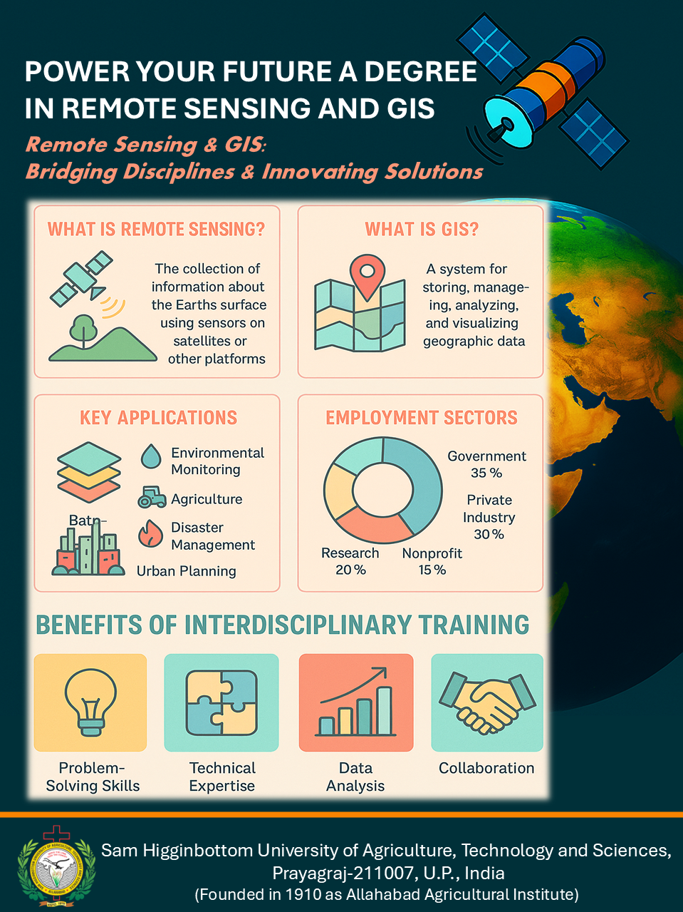
The Centre caters the needs and requirements of the students seeking a degree in the field of Remote Sensing and GIS. Students from a wide spectrum of various academic backgrounds including Civil Engineering, Computer Science, Agriculture, Forestry, Water Resources, etc., are served through this Unit. The overall objective of the Centre is to train and educate the students to integrate the various remote sensing and GIS technologies for improved resource management and assessment.
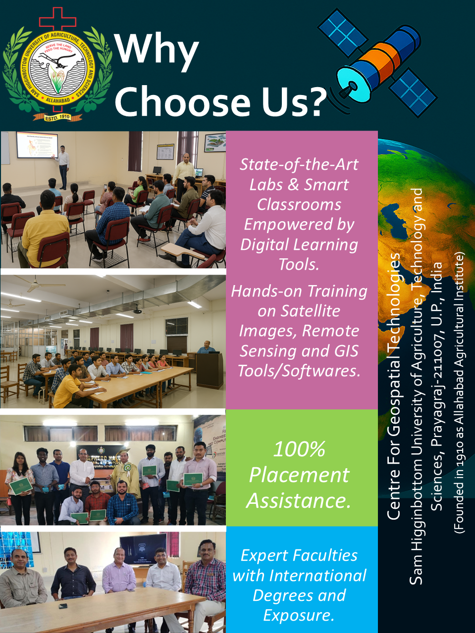
The Centre is comprised of highly skilled and experienced faculty with most of them having international degrees and exposure from places such as USA and Europe. Additionally, the Centre has a dedicated laboratory equipped with latest computers and softwares providing excellent opportunity to learn and practice various remote sensing and GIS techniques. The Centre is consistently striving for performing quality research, teaching and extension as well to provide consulting services in the field of remote sensing and GIS.
Eligibility: B.Sc. [(Ag.)/Forestry] (4 years), Environmental sc. / Geo-Physics / Soil Science / Meterology / Natural Resource Mgt. or related field (Marks: Minimum 50% or 5.5 CGPA)
Fee: 23250 / Sem.
Seats: 10
Duration: 4 Sem
Eligibility: B.E. or B. Tech. Ag. Engg. / Water Resource Engg./Civil Engg./ Comp. Sc./M.Sc. in Agronomy / Forestry / Physics / Environmental Sc. /Geophysics /Soil Science / Meterology / Natural Resource Mgt. / Comp. sc./ MCS or related field (Marks: Minimum 50% or 5.5 CGPA)
Fee: 23250 / Sem.
Seats: 10
Duration: 4 Sem
Eligibility: Regular Masters Degree with minimum 55% or 6.00 CGPA in relevant subject
Fee: 70000 / Sem.
Seats: 10
Duration: 4 Sem
Eligibility: B.E. or B. Tech. Ag. Engg. / Water Resource Engg./ M. Sc. Agriculture / M. Sc. Forestry (Marks: Minimum 50% or 5.5 CGPA)
Fee: 14000 / Sem.
Seats: 10
Duration: 2 Sem


Sam Higginbottom University of Agriculture, Technology And Sciences,
Rewa
Road, Naini, Prayagraj (Formerly Allahabad) -211007, Uttar Pradesh, INDIA
For Admissions Enquiry-
+91-8960350259, 8887830378
admission@shuats.edu.in
www.shuats.edu.in

Vice Chancellor-
+91-532 - 2684284, 2684290
vicechancellor@shuats.edu.in
+91-532 - 2684393
Registrar-
+91-532 - 2684281, 2684781
registrar@shuats.edu.in
+91-532 - 2684394
www.shuats.edu.in
![]()